If you are an Abuja resident, an investor looking to buy real estate, or just interested in how the capital city of Nigeria manages its land records, you will eventually hear about AGIS—the Abuja Geographic Information Systems.
For many residents, investors, and real estate practitioners, AGIS is a core component of how land ownership, mapping, and urban planning are facilitated in the Federal Capital Territory (FCT).
So what does AGIS do exactly? Why is it so important, and how can you interact with it if you need to register land, verify property ownership, or obtain approvals? This guide will break it all down, regardless of whether you are a first-time land buyer, a seasoned real estate developer/investor, or just trying to understand how Abuja is set up behind the scenes.
What is AGIS Abuja?
The Abuja Geographic Information Systems (AGIS) serves as the principal agency for managing land data and geographic information in Nigeria’s capital. Established in 2003, AGIS was born to bring order, transparency, and technology to Abuja’s land administration process.
Prior to AGIS, the land management process in the FCT was plagued with issues such as incomplete records, conflicting allocations, disputes over ownership, and fraudulent conduct. AGIS sought to address these issues by employing Geographic Information Systems (GIS) technology to maintain digital documents of maps and property databases that are open, reliable, and more difficult to alter.
In concise terms:
- To register land, you go to AGIS.
- To ascertain the authenticity of a property, AGIS will confirm.
- AGIS has a map displaying the districts and plots in Abuja.
- For building approvals or permit requests, AGIS will play a significant role.
AGIS was established as an agency of the Federal Capital Territory Administration (FCTA) and works collaboratively with the Department of Lands, Urban and Regional Planning, and other related agencies.
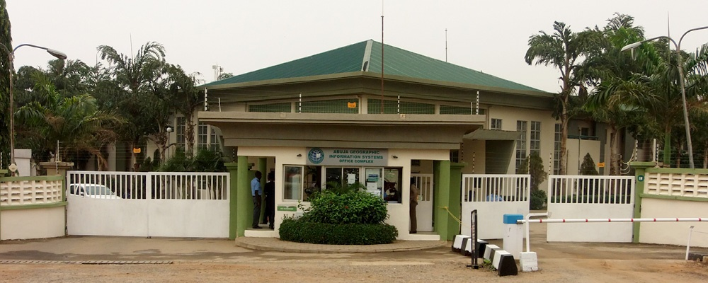
Location & Contact Information
- Address: Area 11, FCTA Secretariat, Kapital Rd, Garki, Abuja, FCT
- Phone: +234 8035879356 (Servicom), +234 0800022553282 (MTN), +234 8099936312 (9Mobile)
- Website: FCTA AGIS Portal
At the top, AGIS is led by a director appointed by the FCT Minister and supported by professional and technical surveyors and GIS specialists.
Key Services Offered by AGIS
AGIS exists to support more open and efficient land administration.
They provide a variety of services, which include:
- Land Registration: Facilitating the registration of newly allocated parcels of land, documenting ownership of land, and issuing Certificate of Occupancy (C-of-O).
- Property Survey: Providing surveys and keeping track of land parcels, down to the coordinates, to limit overlap and disputes.
- GIS Mapping: Tracking parcels, layout, roads, utilities, and natural features across the FCT in a digital map format.
- Title Verification: Enabling buyers and investors to verify that a land title is valid before paying for parcels of land.
- Building Approvals & Permits: Co-operating with other agencies to approve construction, ensuring zoning and compliance with the Abuja master plan.
- Land Information Services: Providing certified true copies of documents, search reports, and other official documentation required for legal or investment purposes.
- Data for Planning: Providing data sets to the government agency, urban planners, and researchers to enhance all development projects.
AGIS digitising these services reduces the risks of fraud and, in general, is faster than the previous manual processes.
How to Access AGIS Services
You can access AGIS services and information in two ways: online and in person.
- Online Access
You can:
- Conduct land searches
- Check plot’s ownership
- Pay some fees online and
- Access property records and GIS.
This is efficient and allows investors, even those not living in the city, to engage with AGIS without coming to Abuja.
2. In-person Access
You can process complex services like registering new plots, submitting documents for validation, and dealing with issues or disputes on-site at AGIS Headquarters, located in the Central Business District.
Office hours
- Mondays to Fridays; 8:00 am to 4:00 pm
- Closed weekends and on public holidays.
Whenever possible, it is best to arrive early, bring all required documents, and be prepared to join the queue since AGIS is one of the busiest offices in Abuja.
Why AGIS is Important for Abuja Residents & Investors
AGIS may sound like just another government agency, but it matters for anyone dealing with land, housing, and business in Abuja.
- Curbing Fraud: Abuja has witnessed multiple instances of fake land allocations, and AGIS helps us verify genuine titles.
- Urban Planning: With GIS data, the city can expand in a planned manner, thereby preventing slums or unplanned settlements.
- Property Value Security: Registering a title with AGIS adds value and guarantees to any property.
- Foreign Investment Confidence: Foreign investors will ask, “Can I trust this land deal?” AGIS will give some answers with records and verification.
- Government Revenue: AGIS generates a significant amount of internally generated revenue for Abuja through land charges and registration fees.
Common FAQs About AGIS Abuja
- What steps must be taken to register land with AGIS?
To have land registered, you need to submit your allocation documents, including the survey plan, to AGIS. The AGIS will verify and provide the Certificate of Occupancy once all details have been confirmed.
- What is the cost?
Costs will be based on plot size, location, and application type. There will be a fee for the survey, registration, and issuance of documents. It is advisable to refer to AGIS separately for the fee list.
- How long does a property survey take?
A standard survey may take a few weeks to complete based on backlog and complexity. Delays sometimes occur, though, due to an increased volume of requests.
- Can foreigners register property in Abuja?
Yes, foreigners can acquire and register property in the city, provided they produce the requisite documentation in accordance with Nigerian law. Many expatriates working with embassies and multinational corporations privately own real estate in Abuja.
- Who is the head of AGIS Abuja?
The current head of the Abuja Geographic Information Systems (AGIS) is Mr Umar Sayyadi, who was appointed as the Overseeing Director in January 2025.
Conclusion
The Abuja Geographic Information Systems (AGIS Abuja) is the nerve centre of land administration in Nigeria’s capital. By harnessing technology, transparency, and structure, AGIS has provided order to what was once a chaotic and fraud-prone system.
If you are planning to purchase land, build a home, or invest in Abuja’s booming real estate market, save this page and, more importantly, make AGIS Abuja a part of your preparation.