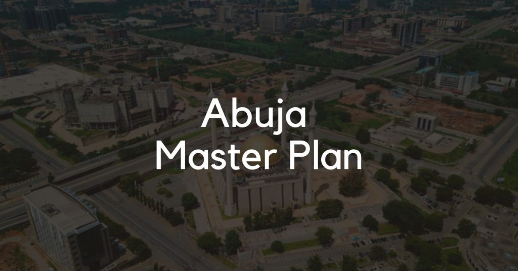
In 1979, the Federal Military Government of Nigeria approved an Abuja Master Plan for the urban planning and development of a modern, befitting capital city.
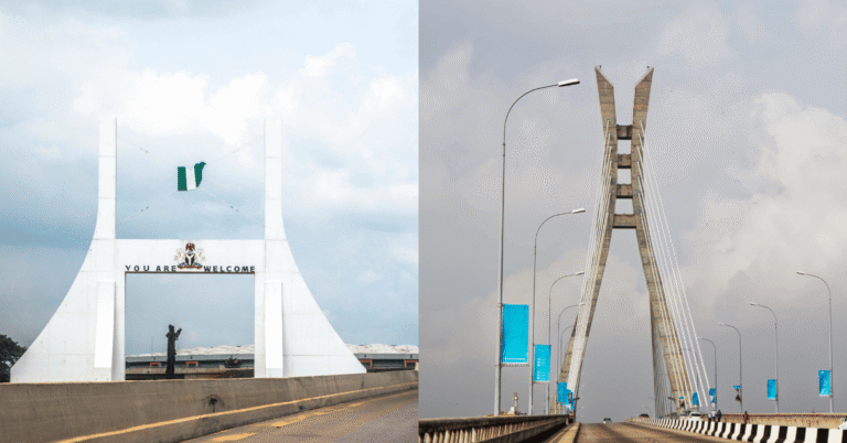
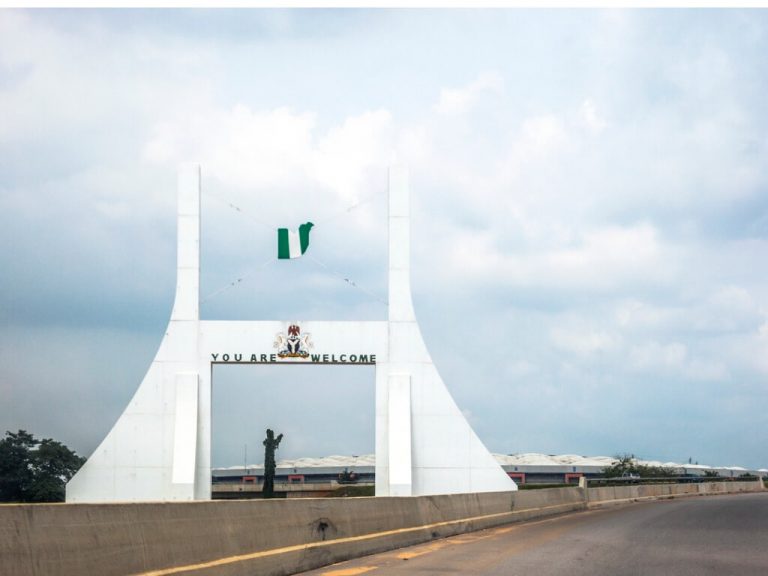
Abuja is widely known today as the capital of Nigeria and the Federal Capital Territory (FCT) but it wasn’t always so. Before 1991, Lagos was the Federal Capital and housed the seat of government. A new capital city was considered only when it became evident Lagos didn’t have the potential to continue as Nigeria’s capital.
In this post, we’ll take a look at what exactly is the Abuja Master Plan, who designed it, and all you need to know about it.
What is the Abuja Master Plan?
The Abuja Master Plan was created by a team of urban city planners to ensure adequate planning, ease, and coordination of developmental efforts in the capital city of Abuja.
Before Abuja came into the picture, Lagos was the capital city of Nigeria.
Due to a number of noticeable geographic and socio-political issues, the Federal Military Government of Nigeria observed that the South-Western state might not be a great location choice for the Federal Capital City.
Justice Akinola Aguda Led Committee
In 1975, the Federal Military Government of Nigeria set up a committee led by Justice Akinola Aguda to find out whether Lagos was capable of remaining as the Federal Capital City.
Born in Akure, Justice Akinola Aguda (1923 – 2001) was a Yoruba Nigerian jurist and a former Chief Justice of Botswana. Prior to becoming Chief Justice, he was a lawyer and a High Court judge in Nigeria’s Western Region.
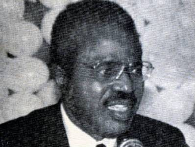
The committee was to recommend suitable alternative sites for the capital if it was established that Lagos couldn’t continue serving as the capital.
After their research and investigation, the committee advised that the Federal Capital be moved from Lagos to a central geographical area with adequate land mass for development. The area selected for the new Federal Capital Territory was Abuja.
Some of the reasons offered by the Committee for this transition to Abuja include:
- Lagos has inadequate space for development and couldn’t function as a Federal Capital City.
- Having a Yoruba majority population, Lagos is ethnically and predominantly home to one ethnic group. A befitting capital city should be in a more central location that’s equally accessible to Nigeria’s great diversity of cultural groups.
- A capital city should be ethnically neutral, centrally accessible, have a beautiful landscape, and have enough land mass for urban development.
- The new capital is also necessary to be a symbol of Nigeria’s aspirations for national unity and greatness.
- They also believed that a shift to Abuja would balance developmental efforts in the country and bring employment and economic opportunities to Nigeria’s ‘middle belt’ region, encompassing Niger, Kwara (now Kogi), and Plateau (now Nasarawa) states.
Due to its centrality, availability of land mass, and accessibility to all parts of Nigeria, Abuja was anointed as the perfect successor for the Federal Capital Territory.
So to kickstart the development of the new area, an urban master plan that followed global standards was essential.
FCT Decree No. 6 of 1976
On 3 February 1976, the Federal Military Government of Nigeria, headed by General Muhammad Murtala, established Abuja as the new Federal Capital and passed the Federal Capital Territory Decree No. 6.
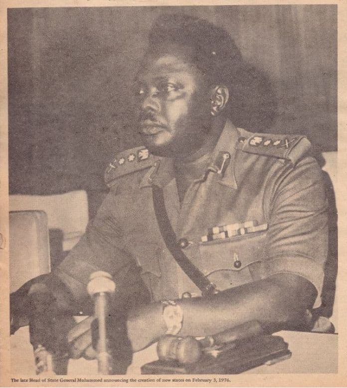
This was done after receiving the recommendations of the Justice Akinola Aguda Led Committee.
The FCT Decree Act of 1976 contained various laws specific to the FCT for:
- Legalizing the creation of the Federal Capital Territory (FCT)
- Ensuring that the Federal Capital must be moved from Lagos to Abuja in 20 years
- Placing the entire land mass of the FCT under the control of the Federal Government
- Putting the responsibility of spatial planning and development of the FCT under the Federal Capital Development Authority (FCDA)
Who Designed The Abuja Master Plan?
The International Planning Associates (IPA) designed and developed the Abuja Master Plan in June 1977. IPA is a consortium of three American architect firms commissioned by the Federal Capital Development Authority (FCDA).
The consortium didn’t exist before the Federal Military Government’s plan to hire a reputable global firm for the master plan. They only came together to win the competitive bid and disbanded after completing the project.
The firms that make up IPA were Planning Research Corporation (PRC), Wallace, McHarg, Roberts & Todd, and Archisystems (a division of the Hughes Organisation).
After the FCDA commissioning, the IPA began a planning process that lasted 18 months. During this period, they did “a review of relevant data, the selection of a capital city site, the preparation of regional and city plans and an accompanying design and development standards manual.”
About The Abuja Master Plan
On 15 February 1979, the Abuja Master Plan report was submitted to the pioneer Executive Secretary of FCDA, Alhaji Abubakar Koko. It was thereafter approved by the Federal Military Government.
The preface to the IPA report reads:
“The master plan for Abuja, the new Capital City of Nigeria, represents the culmination of 18 months work by the Federal Capital Development Authority (FCDA) board, several advisory panels, and consultants. Without the unstinting efforts of these experts, the momentum now exhibited at the beginning of the actual implementation of the new capital could not have been achieved. The plan itself represents a milestone in the process of building the new capital city. It is a necessary element in the monumental effort to be undertaken by the Nigerian people.”
The Abuja Master Plan was developed to provide long-term guidance for the effective implementation of the new capital city.
The report that was submitted extensively covers maps, land use, housing, transportation, cost-efficient infrastructural facilities, and a general development framework for long-term planning for various systems and sectors.
Created with a 25+ year focus, the Abuja Master Plan was also intended to recognize uncertainty and make provisions for unforeseen circumstances.
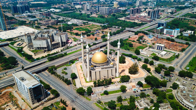
Developments of the FCT began in the geographical centre of Nigeria on a landmass occupying about 8 000 square kilometres (km2). The Federal Capital City (FCC) of Abuja occupies about 250 km2.
On 12 December 1991, the seat of Government was established in Abuja and this signaled the transition of the Office of the President to Abuja.
Abuja Master Plan Map
Here’s a map of the Abuja Master Plan that shows the phases in the Federal Capital City (FCC).
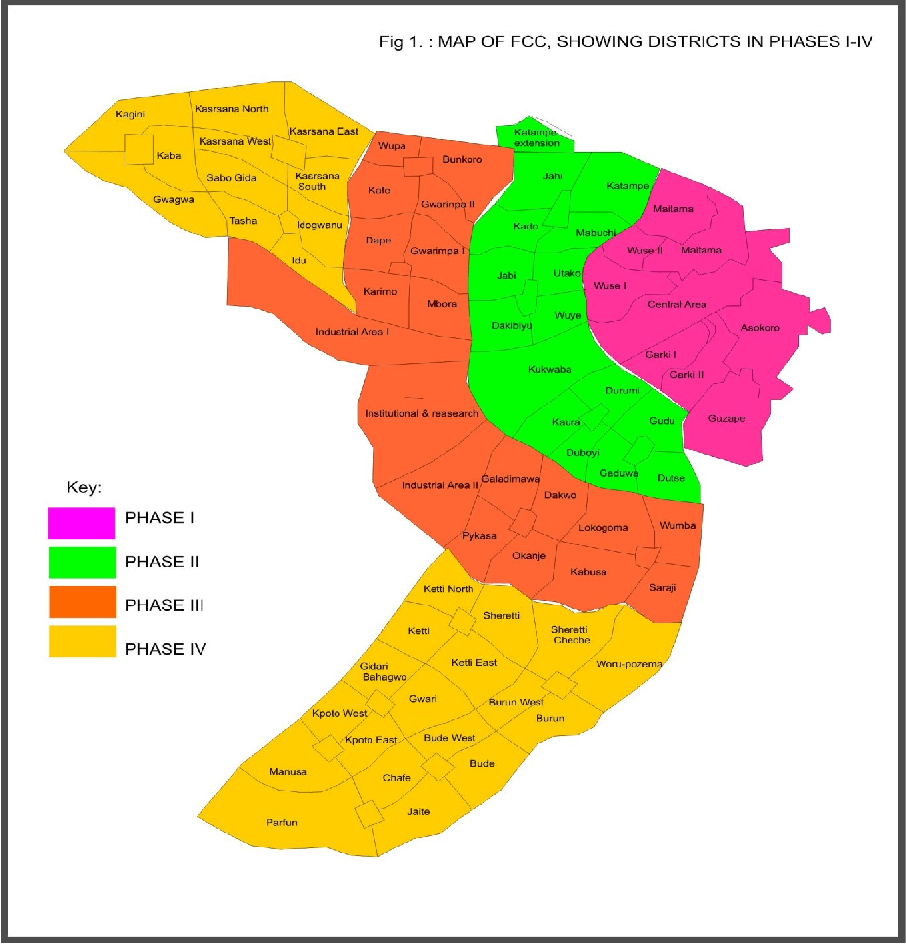
The five Abuja phases cover a total of 1,000 sq km.
Each phase contains several districts for residential, governmental, or commercial purposes. Each of these districts also has its streets, neighborhoods, markets, and public infrastructure.
Now, let’s take a deep dive into each Abuja phase and its districts.
Abuja Phases & Districts
During the planning process, the Federal Capital City was divided into five phases for organized execution.
Here’s a rundown of all five phases and individual districts.
Phase 1
Phase 1 is the most developed area in the capital city with sought-after districts.
Each district has sophisticated neighborhoods, estates, magnificent houses, excellent public infrastructure, an extensive road network, and premium real estate properties.
Here are the districts you’ll find in Phase 1:
- Asokoro
- Central Area
- Garki
- Garki II
- Guzape I
- Guzape II
- Maitama
- Wuse
- Wuse II
Phase 2
Phase 2 is also a well-developed area with beautiful districts, great infrastructure levels, and an extensive road network.
It can be closely compared to Phase 1 in terms of development and infrastructure.
There are fifteen (15) districts in Abuja Phase 2 which include:
- Apo-Dutse
- Dakibiyu
- Duboyi
- Durumi
- Gaduwa
- Gudu
- Jabi
- Jahi
- Kado
- Katampe
- Kaura
- Kukwaba
- Mabushi
- Utako
- Wuye
Phase 3
Phase 3 is a little developed and located further away from the city centre. The area is relatively affordable to live in, has decent public infrastructure levels, and enjoys accessible road networks. Some districts are still undergoing development here.
Phase 3 has about seventeen (17) districts which include:
- Bunkoro
- Dakwo
- Dape
- Galadimawa
- Gwarinpa
- Industrial Area
- Kabusa, Kafe
- Karmo
- Life Camp
- Lokogoma
- Nbora
- Okanje
- Pyakasa
- Saraji
- Wumba
- Wupa
Phase 4
Phase 4 is further away from the centre of the Federal Capital City (FCC). The area has an evident absence of basic infrastructure in the area.
It is mostly filled with unused land and has not seen substantial development. Real estate assets are quite cheap here, compared to the first three phases.
Some of the districts in Phase 4 include:
- Bude
- Burun
- Chafe
- Gidari Bahagwo
- Gwagwa
- Gwari
- Idogwari
- Idu
- Jaite
- Kaba
- Kagini
- Karsana
- Ketti
- Kpoto
- Mamusa
- Parfun
- Sabo Gida
- Sheretti
- Tasha
- Waru-Pozema.
Phase 5
Phase 5 consists of satellite town clusters. They are mostly located outside the city and in areas near Abuja’s airport road. Districts in Phase 5 include Kyami and Lugbe.
Suburban Districts
There are some suburban districts in the FCT that were not originally part of the master plan. However, due to relative proximity to the capital city, these settlements have gained popularity and witnessed development.
Notable suburban districts around Abuja include Kubwa, Nyanya, Karu, Kuje, Jikwoyi, Mpape, and Dawaki.
Final Words
Urban planning and development in the FCT did not happen by chance or randomly come to life.
The Abuja Master Plan was strategic to the development of a modern, befitting new capital city in 1797. With this plan, the capital city was organized into phases and gradually developed in an orderly fashion.
Got questions about the Abuja Master Plan?
Do leave a comment below.
FACT CHECK: We strive for accuracy and fairness in our content curation and reporting.If you see something that doesn't look right, please don't hesitate to contact us!
JOIN WHATSAPP COMMUNITY: Loved this post? You'll love our community more. Feel free to join our WhatsApp community today and be prepared to discover all of Abuja's best-kept secrets!
What is the plan for the original owners of the land?
Was a land without inhabitants?